MENU

Proposed Route

The route shown on this page is the route that was preferred by most people that responded to the Initial Options .

The detailed design of the preferred route is now proposed below for this phase of consultation. We have presented the route in fourkey sections along the route to help you see the detail of what is proposed. These 4 sections are shown on the overall plan below.

After you’ve looked at all four sections below, you will be asked about the route overall. If you have specific comments about any of the four sections, please tell us using the spaces provided as you go through.

Lorne Street

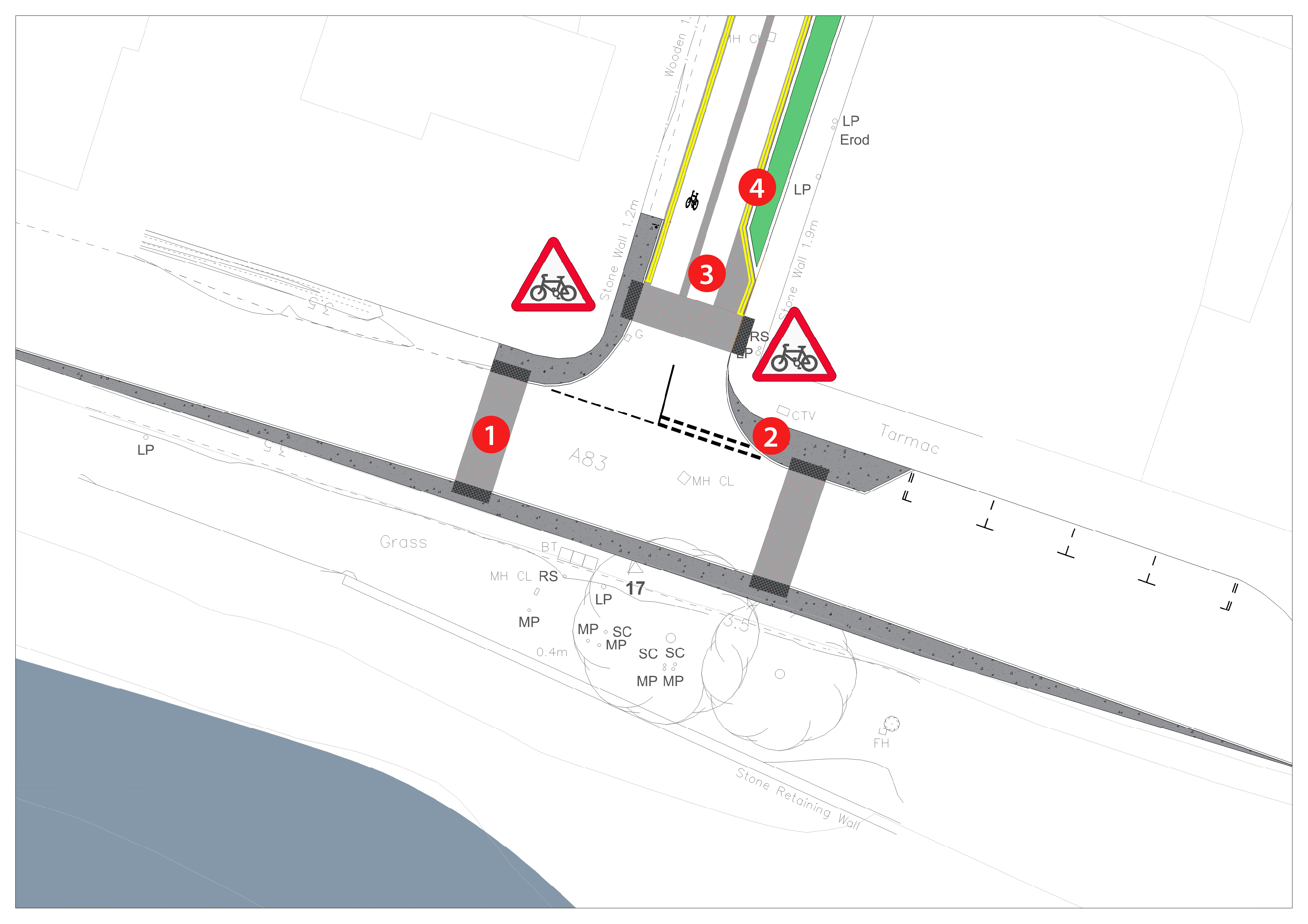
A83/Lorne Street junction

  1. Crossing points across the A83 and Lorne Street formalised to suit existing desire paths. Change of surfacing colour with rolled in red chips as a visual reinforcement that the area is a cycle and pedestrian priority area in line with the Government Street User Hierarchy. 

  2. Footway build outs at the junction to tighten junction geometry, where space permits, to encourage lower speeds within the area. Build outs will also and to help to provide more space for pedestrians and reduce crossing distances.

  3. Edge strips and median strips are provided on Lorne Street as visual reinforcement to drivers that they are within an area of cycle priority. Cycle signs on the carriageway to encourage cyclists to position themselves in the middle of the carriageway and remind
    drivers of cyclists’ presence.

  4. Rain gardens are incorporated into the eastern edge of Lorne Street to add a green edge to the area and to provide physical trac calming. Rain gardens provide additional benefits, including surface water attenuation and treatment, helping to alleviate the existing drainage network. 

Click the image or use the arrows to compare before / after

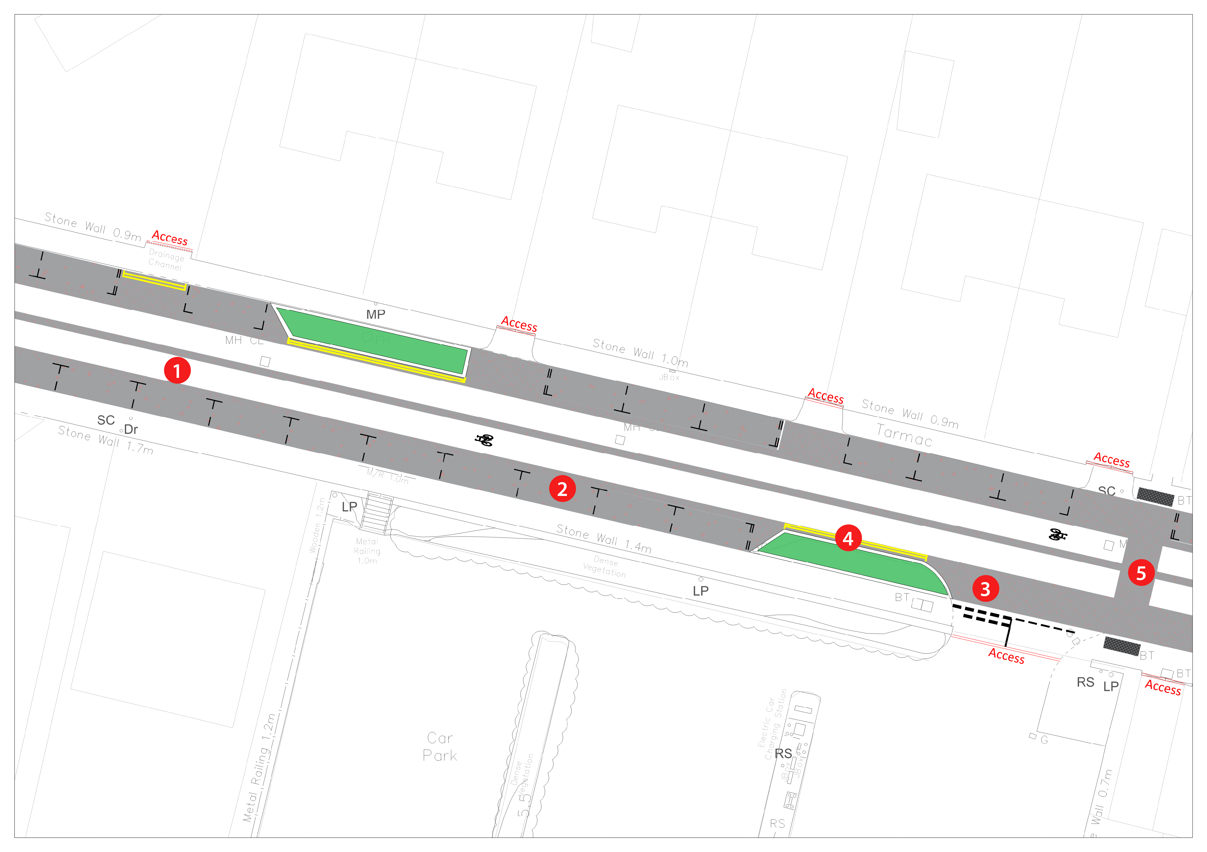
Lorne Street Section

  1. Edge strips and median strips provided on Lorne Street as visual reinforcement to drivers that they are within an area of cycle priority in line with the Government Street User Hierarchy.

  2. Formalised parking within the area to retain a consistent number of parking spaces to residents and visitors while allowing for vehicle movement as present.

  3. Access to and from Lorne Street car park retained as existing.

  4. Rain gardens incorporated along Lorne Street to provide a green edge to the area. Rain gardens provide additional benets including surface water attenuation and treatment, helping to alleviate existing drainage network.

  5. New crossing follows desire path of footway network extending to the north and south of Lorne Street.

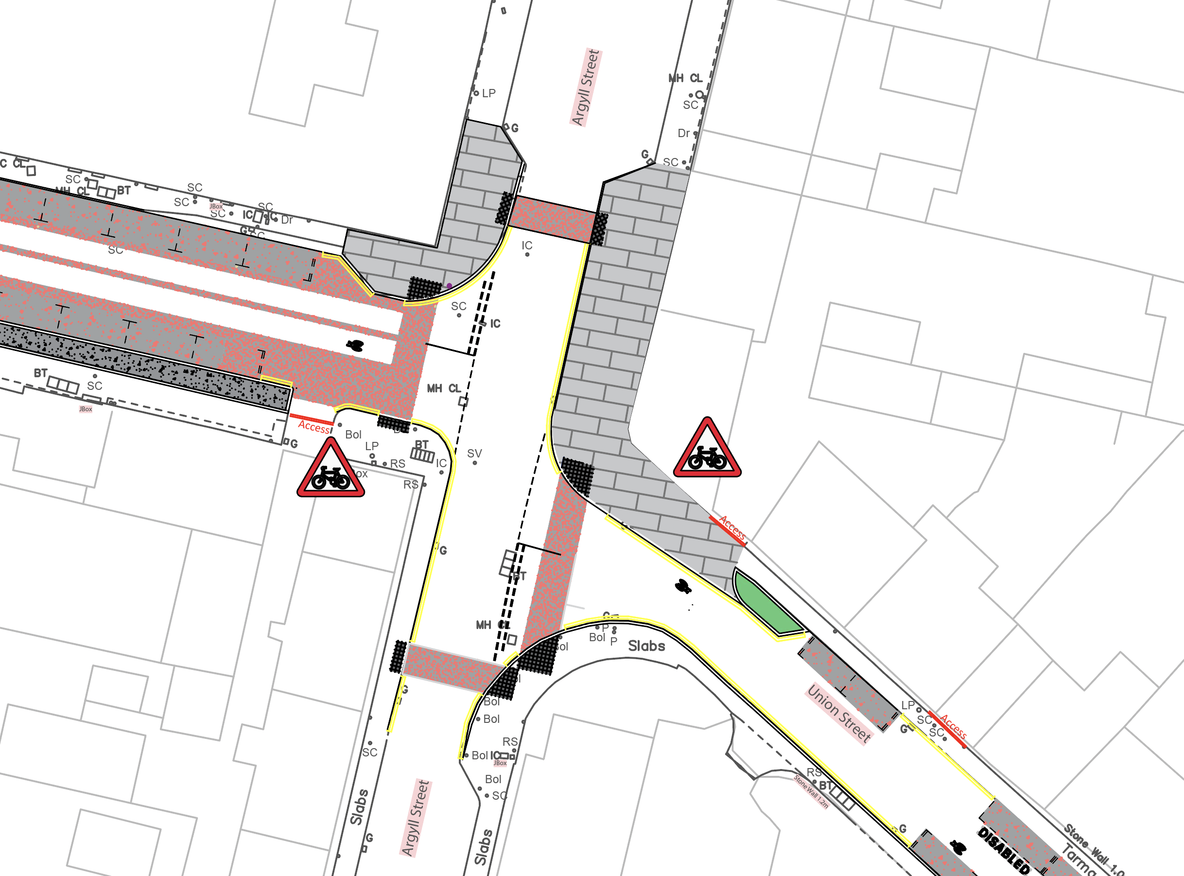
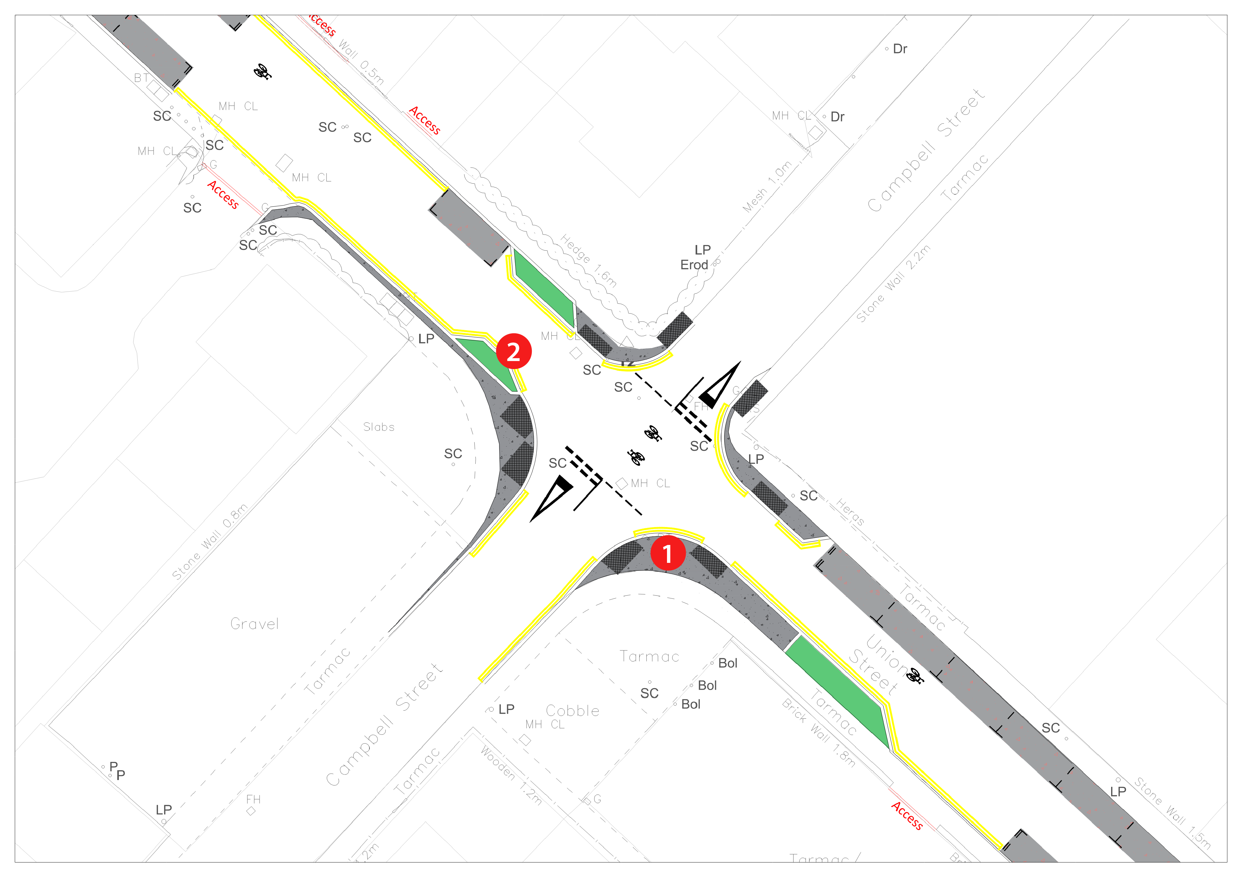
Lorne/Argyll/Union Street Junction

  1. Surface treatment at junction at Lorne St/Argyle/Union St consistent throughout scheme to ensure visual clarity of pedestrian/cycle priority across scheme.

  2. Cycle User signs at beginning of Union Street and Lorne Street to alert drivers they are in a cycle priority area.

  3. Footway improvements on the north quadrants of the Lorne St/Argyle/Union St increase the aesthetic appeal of the area and provide an upgrade on existing surfacing

Do you have any comments about this section of the route?

Union Street

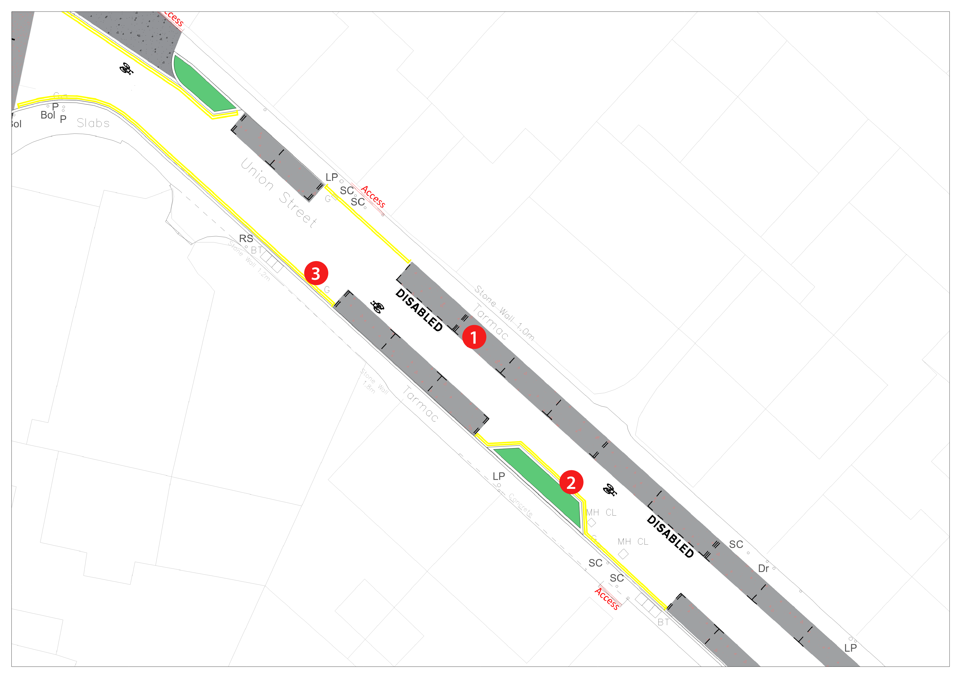
Union Street Section

  1. Formalised standard and disabled parking bays within
    the area to retain a consistent number of parking spaces
    to residents and visitors.

  2. Rain gardens proposed on carriageway adjacent to
    footway, adding a green edge to the route. Rain gardens
    provide additional benets including surface water
    attenuation and treatment, helping to alleviate existing
    drainage network.

  3. Double yellow restrictions shown to retain access to
    commercial properties and ensure adequate space for
    vehicles to navigate in both directions along Union
    Street, as per existing case.


Union Campbell Street Junction

  1. Footway build outs at the junction to tighten junction
    geometry, where space permits, to encourage lower
    speeds within the area. Build outs will also and to help to
    provide more space for pedestrians and reduce crossing
    distances.

  2. Rain gardens in the area provide a green edge while also
    acting as a trac calming measure on Union Street. Rain
    gardens provide additional benets including surface
    water attenuation and treatment, helping to alleviate
    existing drainage network.

Do you have any comments about this section of the route?

Old Primary School area

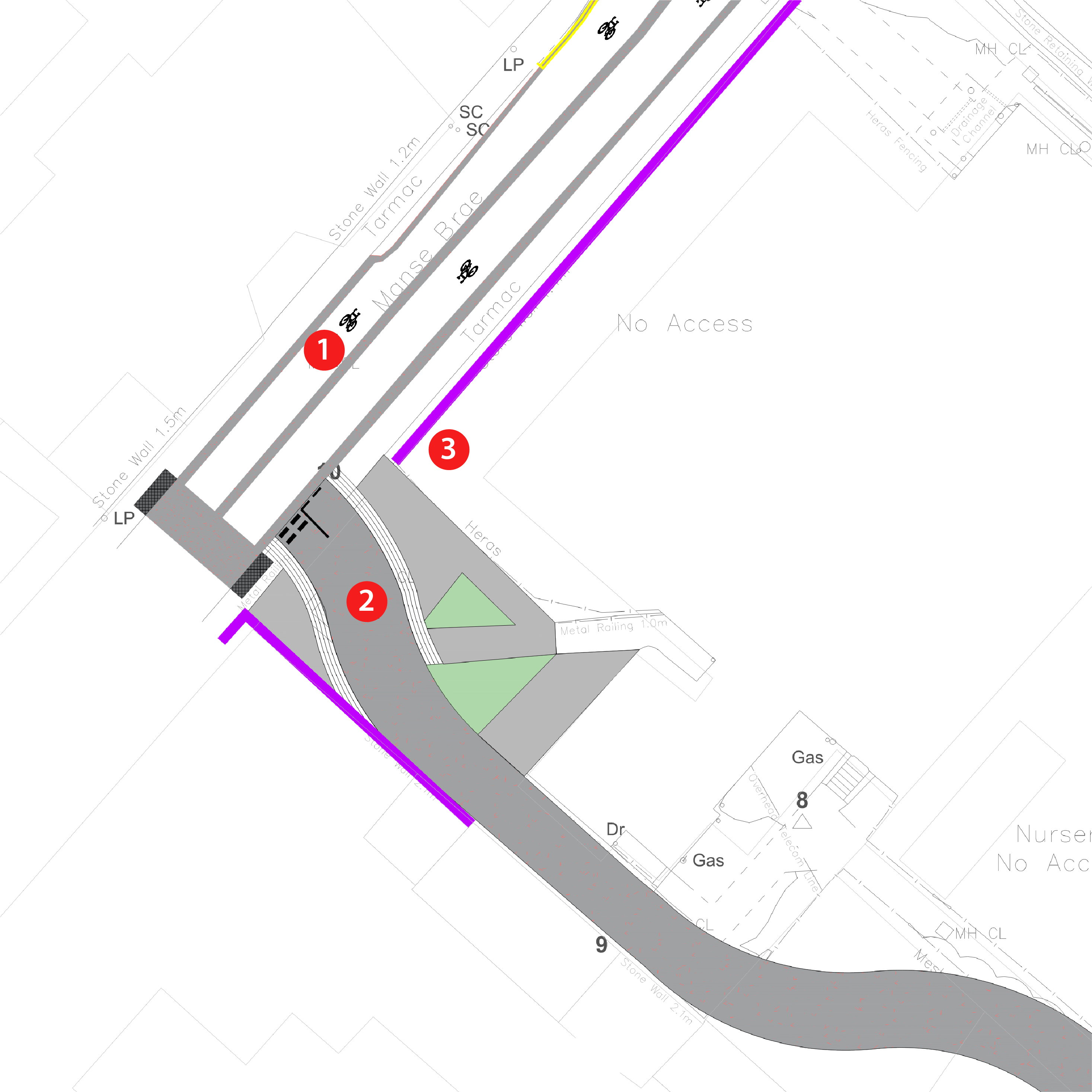
Manse Brae Shared Path Junction

  1. Crossings, roundels, edge strips and median strips provided
    on manse brae as visual reinforcement to drivers that they
    are within an area of cycle priority. Colour and layout kept
    consistent for visual clarity across scheme.

  2. Widening of existing path for use as shared use path in line
    with Cycling by Design Guidance.

  3. Existing walls retained in place.

Do you have any comments about this section of the route?

Kilmory Road

Whitegates Road Crossing

  1. Signallised toucan crossing across Whitegates road to
    ensure cycles/pedestrians are able to safely cross
    Whitegates Road to continue on route.

  2. Enhancement of the public space to the north and south
    of Whitegates Road to help create a more inviting space
    and provide placemaking and greenspace opportunities.

  3. Shared use path on the north and south approaches to
    the crossing, linking the crossing to the cycle-priority
    carriageway at Kilmory road to the north and
    Lochgilphead Joint Campus and existing non-vehicular
    path in the south.


Click the image or use the arrows to compare before / after

Do you have any comments about this section of the route?

What do you think?

Please tell us what you think about the proposals as a whole.

Click here to see examples of similarly designed routes.